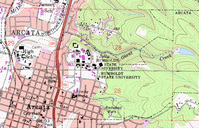
Contour lines, also called isolines, connect points of the same elevation. You've seen contour lines in topographic maps like the one below (which is a bit dated).
If we draw a line across any DEM and then extract the values from the pixels, we will produce a "profile" of the elevation along the line.
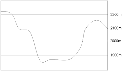
Cross section of a DEM showing lines of equal-elevation
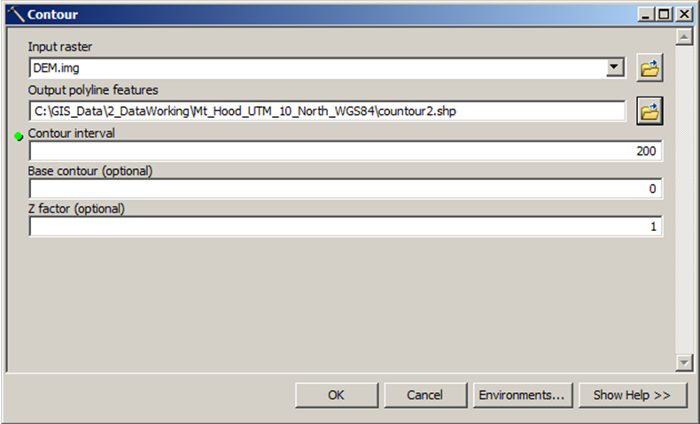
When we produce "contour" lines, we are producing polylines that follow the pixels of "equal elevation" in a DEM.
In ArcMap, the "Contour" tool generates a polyline shapefile.
Below is an example of contour lines overlaid on a DEM of Humboldt Bay, California overlaid on a DEM of the area.

© Copyright 2018 HSU - All rights reserved.